Donate
  • Events
  • Contact the Hilltown Land Trust
  • Join Our Mailing List
  • Facebook
  • Instagram
  • LinkedIn
  • RSS
  • Twitter
  • YouTube

Hilltown Land Trust

Dedicated to protecting the working lands, native habitats and rural beauty of the Hilltowns since 1986

  • About
    • Board & Committees
    • Staff and TerraCorps members
    • Affiliation with The Trustees
    • Announcements
    • Newsletters
    • Contact
    • Open Positions
  • Land Protection
    • Conservation Restrictions
    • Agricultural Preservation Restrictions
    • Financial Incentives
    • Donating or Selling Land
    • Estate Planning
    • Landowner & Town Resources
  • Properties
    • Trails & Maps
      • Big View Trail
      • Bradley
      • Breckenridge
      • Conwell
      • Historic Dam Trail
      • Locke’s Loop Trail
      • Robert’s Meadow Brook Trail
      • Round Top Hill
      • Stevens
      • Two Mamas Farm Waterfall Trail
    • Land Stewardship
    • Conservation Stories
  • Get Involved
    • Events
    • Volunteer
    • Donate
    • Support
    • Legacy Giving
    • Gorge après Gorge
    • Vernal Pool Plunge
You are here: Home / Protected Lands post archive / Hiking Trails and Maps / Hiking at Round Top Hill

Hiking at Round Top Hill

Shagbark hickory trunks frame a blue sky and grassy summit top.
Shagbark hickory forest at the Round Top Hill summit

Round Top Hill is the highest peak in Hampden County at 1,780 feet. This property off Round Hill Road in Chester, MA was permanently protected in 2015 through a Conservation Restriction held by Hilltown Land Trust.

The land remains in private ownership, but the landowners allow the public to hike the trails to the summit of Round Top Hill. Please respect the property and stay on the trails.

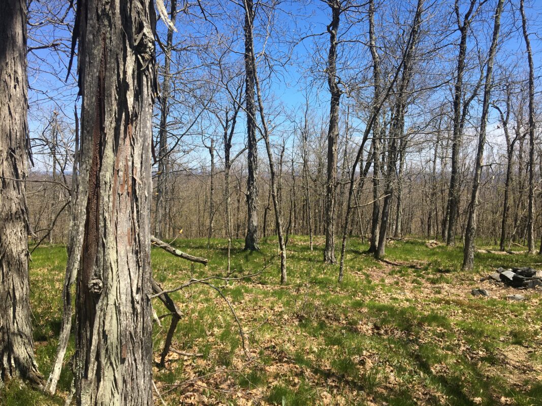
When the leaves are down, hikers have a 360-degree view of Hampden County. Some notable views are the white church in Blandford, Gobble Mountain in Chester, Chester-Blandford State Forest, Beckett Quarry, and sometimes as far east as Mount Tom in Holyoke. Atop the summit there is a unique ecological environment of grassy open areas with scrub oak and shagbark hickory trees.

Hiking Round Top Hill

There are two trails to the summit of Round Top Hill, both leaving from the west side of Round Hill Road.

View from top of Round Hill in winter
photo by Western Mass Hilltown Hikers

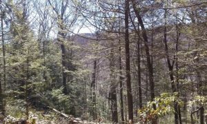
The orange-blazed Round Hill Trail is a moderate-to-steep wooded trail, with one steep section of rock hopping. The trail is .5 miles to the summit. The Round Hill Trail is labeled “Fire Road” on the map below.

The white-blazed section of Unkamit’s Path that leads to Round Top Hill is an even steeper and more challenging approach to the summit, including several steep ledges. The trail is .4 miles over rugged terrain. Western Mass Hilltown Hikers help maintain this trail for the public.

Round Top Hill Trail Map

Complete Trail Map by Western Mass Hilltown Hikers

Parking & Directions

To get to both trailheads, take Route 20 or Route 23 to Blandford Road in Chester.

Turn onto Round Hill Road at the Blandford-Chester Town line.

Follow Round Hill Road.

The small pull off parking lot is on the right for the Fire Road Trail (orange blazed) the kiosk will be on the left side.

The section of Unkamit’s Path which is white-blazed is located a short way north of the junction of Round Hill Rd and Griffin Brook Rd.  Park at the State Park area a short way down Griffin Brook Rd.  Walk back to Round Hill Rd. and walk to the right a short way to a white blaze. There is a triangle carved into a very large oak tree at the trailhead and a caution steep trail sign.

NOTE: The upper portion of Round Hill Road is not maintained by the town of Chester from November 1 to April 15. During this time of year, the only way to access these trails is by parking at the cemetery and walk into Round Hill Road.

Events Calendar

Today
Sun
Mon
Tue
Wed
Thu
Fri
Sat
S
M
T
W
T
F
S
29
30
31
1
2
3
4
10:30 AM - Meditation on Maples
5
6
7
8
9
10
11
12
13
14
15
16
17
18
19
20
21
22
23
24
25
26
9:30 AM - Gorge après Gorge 5k Run/Walk 2023
27
28
29
30
1
2
Meditation on Maples
Nov 4th, 2023    
10:30 am - 12:00 pm
Bullitt Reservation
  • Hands-On
Come get to know the marvelous maples at the Bullitt Reservation! Meditation on Maples is a program that invites participants to explore maple trees with all [...]
More Info
Gorge après Gorge 5k Run/Walk 2023
Nov 26th, 2023    
9:30 am - 1:00 pm
Chesterfield Gorge
  • Family Fun
  • Kids
  • Partnership Event
  • Race
It's that time of year again! Join us for this year’s Gorge après Gorge 5k Trail Run and Free Family Fun Walk on November 26th. [...]
More Info
Events on Nov 4th, 2023
Meditation on Maples
4 Nov 23
Ashfield
Events on Nov 26th, 2023
Gorge après Gorge 5k Run/Walk 2023
26 Nov 23
Chesterfield
  • About
    • Board & Committees
    • Staff and TerraCorps members
    • Affiliation with The Trustees
    • Announcements
    • Newsletters
    • Contact
    • Open Positions
  • Land Protection
    • Conservation Restrictions
    • Agricultural Preservation Restrictions
    • Financial Incentives
    • Donating or Selling Land
    • Estate Planning
    • Landowner & Town Resources
  • Properties
    • Trails & Maps
      • Big View Trail
      • Bradley
      • Breckenridge
      • Conwell
      • Historic Dam Trail
      • Locke’s Loop Trail
      • Robert’s Meadow Brook Trail
      • Round Top Hill
      • Stevens
      • Two Mamas Farm Waterfall Trail
    • Land Stewardship
    • Conservation Stories
  • Get Involved
    • Events
    • Volunteer
    • Donate
    • Support
    • Legacy Giving
    • Gorge après Gorge
    • Vernal Pool Plunge

Learn

  • Announcements
  • Staff and TerraCorps members
  • Contact

Participate

  • Events
  • Volunteer
  • Donate
  • Subscribe

Hike

  • Bradley
  • Breckenridge
  • Stevens
Land Trust Accreditation seal
Contact Us
admin: Log in
© 2023 Hilltown Land Trust | Hilltown Land is a 501c3 nonprofit organization | Est. 1986