Donate
  • Events
  • Contact
  • Join Our Mailing List
  • Facebook
  • Instagram
  • LinkedIn
  • YouTube

Hilltown Land Trust

Dedicated to protecting the working lands, native habitats and rural beauty of the Hilltowns since 1986

  • About
    • Board & Committees
    • Staff and TerraCorps members
    • Affiliation with The Trustees
    • Announcements
    • Newsletters
    • Contact
    • Open Positions
  • Land Protection
    • Conservation Restrictions
    • Agricultural Preservation Restrictions
    • Financial Incentives
    • Donating or Selling Land
    • Estate Planning
    • Landowner & Town Resources
  • Properties
    • Trails & Maps
      • Big View Trail
      • Bradley
      • Breckenridge
      • Clary Hill
      • Conwell
      • Hilltown Boulders
      • Historic Dam Trail
      • Locke’s Loop Trail
      • Robert’s Meadow Brook Trail
      • Round Top Hill
      • Stevens
      • Two Mamas Farm Waterfall Trail
    • Land Stewardship
    • Conservation Stories
  • Get Involved
    • Events
    • Volunteer
    • Donate
    • Support
    • Legacy Giving
    • Gorge après Gorge
    • Vernal Pool Conservation
You are here: Home / Protected Lands post archive / Hiking Trails and Maps / Hiking at the Stevens Property

Hiking at the Stevens Property

boulder
Photo © jo landers

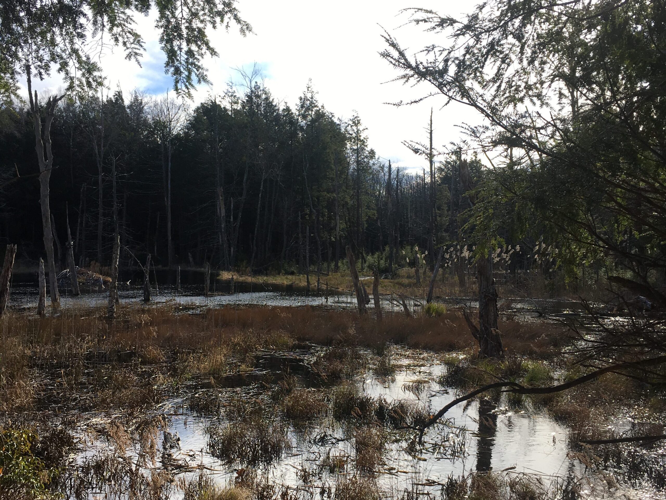
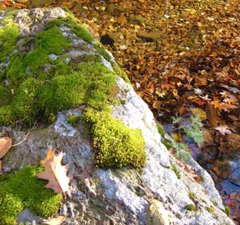
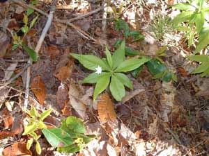
A longer 4-mile loop trail and a shorter 1.2 mile loop trail provide many recreation options on the Stevens Property, off of Pisgah Road in Huntington. These trails wind through a wooded landscape studded with hundreds of large boulders covered in mosses, ferns and lichens. They climb up and down steep slopes and cross a moist stream valley in three places. Other features include a very early cellar hole and maple sugarhouse ruin. Expect lots of early spring wildflowers and a great variety of ferns, and look for signs of moose, deer, bear, coyote, porcupine, and many other mammals.

Starflower - photo © Shirley Winer
Starflower | Photo © Shirley Winer

Snowshoeing, cross-country skiing, and mountain biking are not encouraged, as trails are steep, rocky, and can be slippery when wet. Contact your local snowmobile club about snowmobile trails.

Map

Thumbnail of a map of the Stevens hiking trails.
Trail map of Stevens. Click image for larger version.
Stevens Trail Map

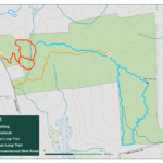
Parking and Directions

At the highest point on Route 66, 0.4 mile west of the Westhampton-Huntington town line, turn north off Route 66 onto Allen Coit Road. Go 0.4 mile to the intersection with Pisgah Road and bear right onto Pisgah. Go 2.4 mile north from that intersection to HLT’s marked parking pullout and small clearing at break in stone wall on the right. Trail begins to the right of the kiosk.

A beaver pond filled with low plants against a background of dark trees.
Beaver pond at Stevens.

Events Calendar

Today
Sun
Mon
Tue
Wed
Thu
Fri
Sat
S
M
T
W
T
F
S
26
27
28
29
30
31
1
2
3
4
5
6
7
8
9
10
11
12
13
14
15
16
17
18
19
20
21
22
23
24
25
26
27
28
1
  • About
    • Board & Committees
    • Staff and TerraCorps members
    • Affiliation with The Trustees
    • Announcements
    • Newsletters
    • Contact
    • Open Positions
  • Land Protection
    • Conservation Restrictions
    • Agricultural Preservation Restrictions
    • Financial Incentives
    • Donating or Selling Land
    • Estate Planning
    • Landowner & Town Resources
  • Properties
    • Trails & Maps
      • Big View Trail
      • Bradley
      • Breckenridge
      • Clary Hill
      • Conwell
      • Hilltown Boulders
      • Historic Dam Trail
      • Locke’s Loop Trail
      • Robert’s Meadow Brook Trail
      • Round Top Hill
      • Stevens
      • Two Mamas Farm Waterfall Trail
    • Land Stewardship
    • Conservation Stories
  • Get Involved
    • Events
    • Volunteer
    • Donate
    • Support
    • Legacy Giving
    • Gorge après Gorge
    • Vernal Pool Conservation

Learn

  • Announcements
  • Staff and TerraCorps members
  • Contact

Participate

  • Events
  • Volunteer
  • Donate
  • Subscribe

Hike

  • Bradley
  • Breckenridge
  • Stevens
Land Trust Accreditation seal
Contact Us
admin: Log in
© 2026 Hilltown Land Trust | Hilltown Land is a 501c3 nonprofit organization | Est. 1986
Manage Consent
To provide the best experiences, we use technologies like cookies to store and/or access device information. Consenting to these technologies will allow us to process data such as browsing behavior or unique IDs on this site. Not consenting or withdrawing consent, may adversely affect certain features and functions.
Functional Always active
The technical storage or access is strictly necessary for the legitimate purpose of enabling the use of a specific service explicitly requested by the subscriber or user, or for the sole purpose of carrying out the transmission of a communication over an electronic communications network.
Preferences
The technical storage or access is necessary for the legitimate purpose of storing preferences that are not requested by the subscriber or user.
Statistics
The technical storage or access that is used exclusively for statistical purposes. The technical storage or access that is used exclusively for anonymous statistical purposes. Without a subpoena, voluntary compliance on the part of your Internet Service Provider, or additional records from a third party, information stored or retrieved for this purpose alone cannot usually be used to identify you.
Marketing
The technical storage or access is required to create user profiles to send advertising, or to track the user on a website or across several websites for similar marketing purposes.
  • Manage options
  • Manage services
  • Manage {vendor_count} vendors
  • Read more about these purposes
View preferences
  • {title}
  • {title}
  • {title}