Donate
  • Events
  • Contact
  • Join Our Mailing List
  • Facebook
  • Instagram
  • LinkedIn
  • YouTube

Hilltown Land Trust

Dedicated to protecting the working lands, native habitats and rural beauty of the Hilltowns since 1986

  • About
    • Board & Committees
    • Staff and TerraCorps members
    • Affiliation with The Trustees
    • Announcements
    • Newsletters
    • Contact
    • Open Positions
  • Land Protection
    • Conservation Restrictions
    • Agricultural Preservation Restrictions
    • Financial Incentives
    • Donating or Selling Land
    • Estate Planning
    • Landowner & Town Resources
  • Properties
    • Trails & Maps
      • Big View Trail
      • Bradley
      • Breckenridge
      • Clary Hill
      • Conwell
      • Hilltown Boulders
      • Historic Dam Trail
      • Locke’s Loop Trail
      • Robert’s Meadow Brook Trail
      • Round Top Hill
      • Stevens
      • Two Mamas Farm Waterfall Trail
    • Land Stewardship
    • Conservation Stories
  • Get Involved
    • Events
    • Volunteer
    • Donate
    • Support
    • Legacy Giving
    • Gorge après Gorge
    • Vernal Pool Plunge
You are here: Home / Protected Lands post archive / Hiking Trails and Maps / Hiking at the Stevens Property

Hiking at the Stevens Property

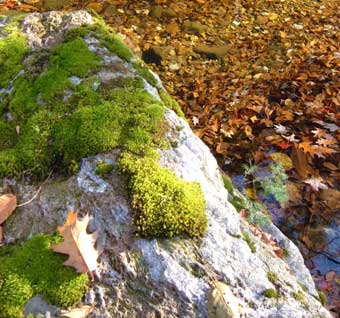
boulder
Photo © jo landers

A longer 4-mile loop trail and a shorter 1.2 mile loop trail provide many recreation options on the Stevens Property, off of Pisgah Road in Huntington. These trails wind through a wooded landscape studded with hundreds of large boulders covered in mosses, ferns and lichens. They climb up and down steep slopes and cross a moist stream valley in three places. Other features include a very early cellar hole and maple sugarhouse ruin. Expect lots of early spring wildflowers and a great variety of ferns, and look for signs of moose, deer, bear, coyote, porcupine, and many other mammals.
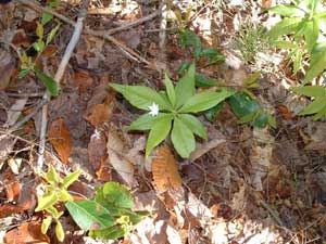
Starflower - photo © Shirley Winer
Starflower | Photo © Shirley Winer

Snowshoeing, cross-country skiing, and mountain biking are not encouraged, as trails are steep, rocky, and can be slippery when wet. Contact your local snowmobile club about snowmobile trails.

Map
Thumbnail of a map of the Stevens hiking trails.
Trail map of Stevens. Click image for larger version.
Stevens Trail Map

Parking and Directions

At the highest point on Route 66, 0.4 mile west of the Westhampton-Huntington town line, turn north off Route 66 onto Allen Coit Road. Go 0.4 mile to the intersection with Pisgah Road and bear right onto Pisgah. Go 2.4 mile north from that intersection to HLT’s marked parking pullout and small clearing at break in stone wall on the right. Trail begins to the right of the kiosk.
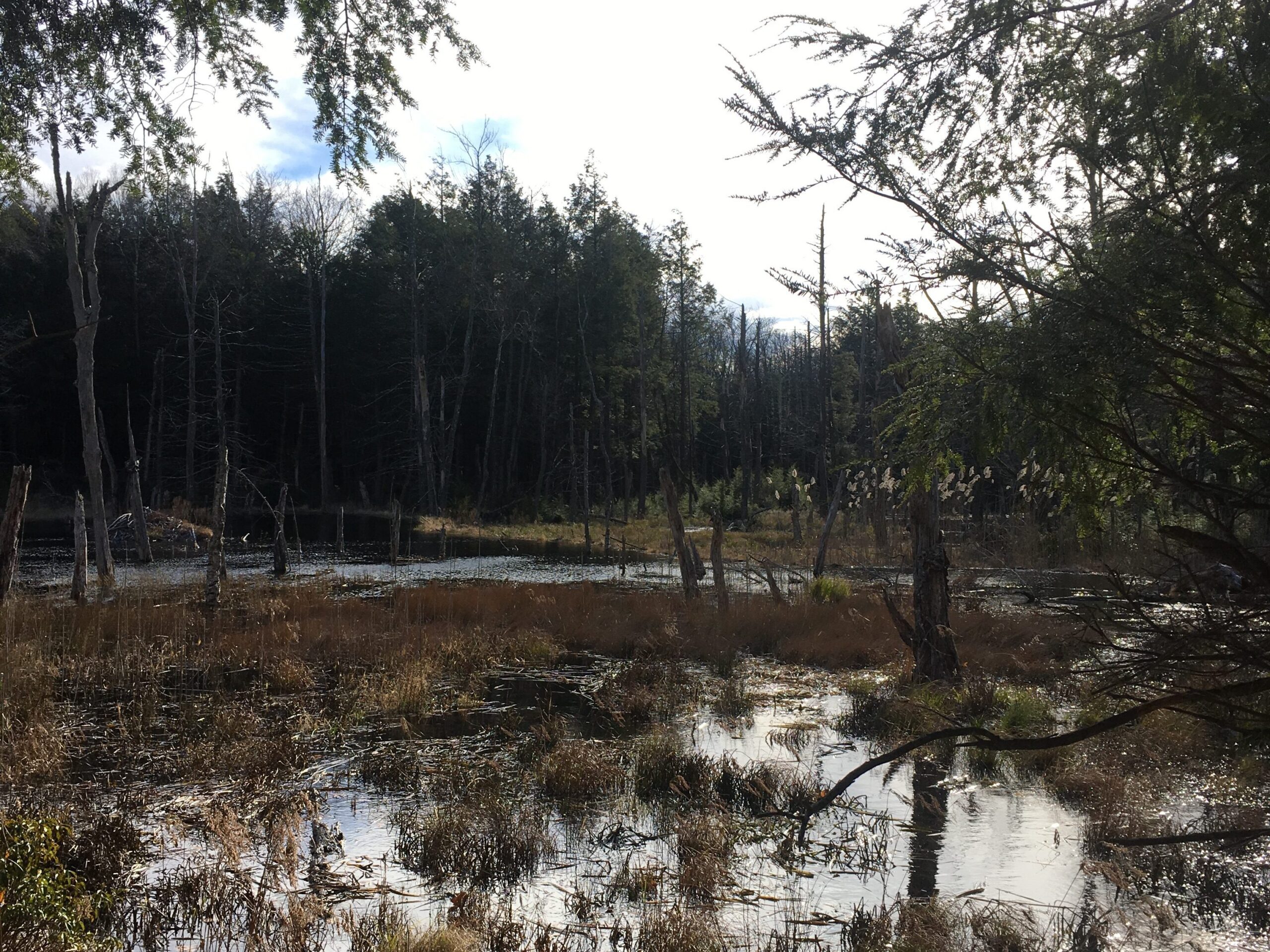
A beaver pond filled with low plants against a background of dark trees.
Beaver pond at Stevens.

Events Calendar

Today
Sun
Mon
Tue
Wed
Thu
Fri
Sat
S
M
T
W
T
F
S
29
30
1
2
3
4
5
6
7
8
9
10
11
12
13
14
15
16
17
18
19
20
21
22
4:00 PM - Create a Lasting Legacy Workshop: How to Support the Causes You Love
23
24
25
26
27
28
29
2:00 PM - What’s in a Forest Assessment? Meet a Forester Woods Walk
30
31
1
2
Create a Lasting Legacy Workshop: How to Support the Causes You Love
Oct 22nd, 2024    
4:00 pm - 5:00 pm
  • Training
  • Webinar
We invite you to join us during National Estate Planning Awareness Week for a FREE Zoom workshop with Attorney Valerie Vignaux. Hilltown Land Trust is [...]
More Info
What’s in a Forest Assessment? Meet a Forester Woods Walk
Oct 29th, 2024    
2:00 pm - 4:00 pm
Unquomonk Town Water Land
  • Hands-On
  • Hike
  • Workshop
Join us on a walk at Williamsburg Town Water Department land with Licensed Forester Ry Patton (Bay State Forestry) and Hilltown Land Trust land stewardship [...]
More Info
Events on Oct 22nd, 2024
Create a Lasting Legacy Workshop: How to Support the Causes You Love
22 Oct 24
Events on Oct 29th, 2024
What’s in a Forest Assessment? Meet a Forester Woods Walk
29 Oct 24
Williamsburg
  • About
    • Board & Committees
    • Staff and TerraCorps members
    • Affiliation with The Trustees
    • Announcements
    • Newsletters
    • Contact
    • Open Positions
  • Land Protection
    • Conservation Restrictions
    • Agricultural Preservation Restrictions
    • Financial Incentives
    • Donating or Selling Land
    • Estate Planning
    • Landowner & Town Resources
  • Properties
    • Trails & Maps
      • Big View Trail
      • Bradley
      • Breckenridge
      • Clary Hill
      • Conwell
      • Hilltown Boulders
      • Historic Dam Trail
      • Locke’s Loop Trail
      • Robert’s Meadow Brook Trail
      • Round Top Hill
      • Stevens
      • Two Mamas Farm Waterfall Trail
    • Land Stewardship
    • Conservation Stories
  • Get Involved
    • Events
    • Volunteer
    • Donate
    • Support
    • Legacy Giving
    • Gorge après Gorge
    • Vernal Pool Plunge

Learn

  • Announcements
  • Staff and TerraCorps members
  • Contact

Participate

  • Events
  • Volunteer
  • Donate
  • Subscribe

Hike

  • Bradley
  • Breckenridge
  • Stevens
Land Trust Accreditation seal
Contact Us
admin: Log in
© 2025 Hilltown Land Trust | Hilltown Land is a 501c3 nonprofit organization | Est. 1986